Investment and Logistics Zone Toruń – East Region No. 8
- 13, 15, 17, 19 Projected CLXXXIX St., 17-21 Gminna St.
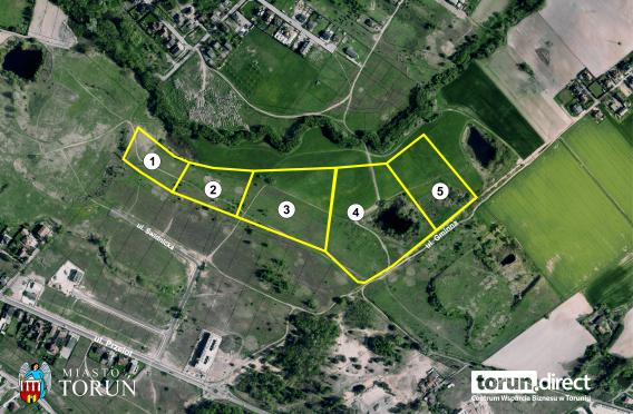
- total area: 9,9429 ha
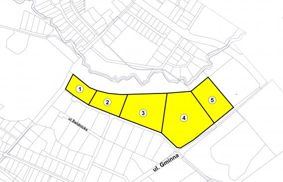
- ambit 54, plots N°: 132/72, 132/73, 132/74, 132/75, 50/5
- number of plots: 5
- owned by the Municipality of Toruń
1. 19 Projected CLXXXIX St. – plot N° 132/72 – 0,8608 ha
2. 17 Projected CLXXXIX St. – plot N° 132/73 – 1,1500 ha
3. 15 Projected CLXXXIX St. – plot N° 132/74 – 2,5003 ha
4. 13 Projected CLXXXIX St. – plot N° 132/75 – 3,6948 ha
5. 17-21 Gminna St. – plot N° 50/5 – 1,7370 ha
- intended use: land for service development
- admissible use: production facilities, warehouses and storage facilities, technical infrastructure, internal roads
- area marked with 157.14-U5 symbol (City Council Resolution N° 897/22 of 21 July, 2022)
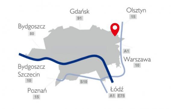
- north-eastern part of the city
- perfect connection with National Roads N° 91, 15, 10, and in the vicinity of the A1 Motorway junction
- in the vicinity of service and production facilities, areas used for large logistics centers
- access from existing public roads, as well as on land designated for future streets and roadways
- existing and planned utilities located in Gminna St. :
- sanitary and rainwater drainage network,
- water distribution network,
- telecommunication network,
- electric power network,
- gas network
Pobierz plik


